產業領域
的黎波里按行业的企业分布
的黎波里的地圖
互動地圖
的黎波里的人口
1975年至2020年
| Data | 1975 | 1990 | 2000 | 2015 | 2020 |
|---|---|---|---|---|---|
| 人口 | 388,158 | 611,427 | 685,478 | 753,530 | 813,288 |
| 人口密度 | 1,819.7 / km² | 2,866.3 / km² | 3,213.5 / km² | 3,532.5 / km² | 3,812.7 / km² |
来源: JRC (European Commission's Joint Research Centre) 工作于 GHS built-up grid
的黎波里从2000年到2015年的人口变化
从2000年到2015年增长了9.9%
| 位置 | 自1975以来的变化 | 自1990以来的变化 | 自2000以来的变化 |
|---|---|---|---|
| 的黎波里 | +94.1% | +23.2% | +9.9% |
| 的黎波里省 | +138.9% | +42.9% | +17.7% |
| 利比亚 | +139.4% | +43% | +17.7% |
来源: JRC (European Commission's Joint Research Centre) 工作于 GHS built-up grid
的黎波里的中位年龄
中位年龄:23.8岁
| 位置 | 年齡中位數 | 中位年齡(女) | 中位年齡(男) |
|---|---|---|---|
| 的黎波里 | 23.8 yrs | 23.8 yrs | 23.7 yrs |
| 的黎波里省 | 23.8 yrs | 23.8 yrs | 23.7 yrs |
| 利比亚 | 23.8 yrs | 23.8 yrs | 23.7 yrs |
来源: CIESIN (Center for International Earth Science Information Network)
的黎波里的人口密度
人口密度:3,813 / km²
| 位置 | 人口 | 區 | 密度 |
|---|---|---|---|
| 的黎波里 | 813,288 | 213.3 km² | 3,813 / km² |
| 的黎波里省 | 1.2 million | 835.5 km² | 1,404 / km² |
| 利比亚 | 6.2 million | 1,614,874.2 km² | 3.9 / km² |
来源: JRC (European Commission's Joint Research Centre) 工作于 GHS built-up grid
的黎波里的历史和预测人口
从1720到2100的估计人口
来源:
- JRC (European Commission's Joint Research Centre) 工作于 GHS built-up grid
- CIESIN (Center for International Earth Science Information Network)
- [鏈接] Klein Goldewijk, K., Beusen, A., Doelman, J., and Stehfest, E.: Anthropogenic land use estimates for the Holocene – HYDE 3.2, Earth Syst. Sci. Data, 9, 927–953, https://doi.org/10.5194/essd-9-927-2017, 2017.
的黎波里的街区
的黎波里各街区企业占比
价格分布
的黎波里企業(按價格分佈)
人類發展指數(HDI)
預期壽命,教育程度和人均收入的統計綜合指數。
来源: [鏈接] Kummu, M., Taka, M. &Guillaume, J. Gridded global datasets for Gross Domestic Product and Human Development Index over 1990–2015. Sci Data 5, 180004 (2018) doi:10.1038/sdata.2018.4
的黎波里的CO2排放
每年人均二氧化碳(CO2)排放量(噸)
| 位置 | 二氧化碳排放量 | 人均二氧化碳排放量 | 二氧化碳排放強度 |
|---|---|---|---|
| 的黎波里 | 3,178,242 tn | 3.91 tn | 14,899.5 tons/km² |
| 的黎波里省 | 4,607,356 tn | 3.93 tn | 5,514.7 tons/km² |
| 利比亚 | 24,635,445 tn | 3.96 tn | 15.3 tons/km² |
来源: [鏈接] Moran, D., Kanemoto K; Jiborn, M., Wood, R., Többen, J., and Seto, K.C. (2018) Carbon footprints of 13,000 cities. Environmental Research Letters DOI: 10.1088/1748-9326/aac72a
的黎波里的CO2排放
| 2013年CO2排放量(吨/年) | 3,178,242 tn |
| 2013年人均CO2排放量(吨/年) | 3.91 tn |
| 2013年CO2排放强度(吨/km²/年) | 14,899.5 tons/km² |
自然災害風險
Relative risk out of 10
| 危险 | Risk Level |
|---|---|
| Drought | High (10) |
| Earthquake | Medium (3.9) |
* Risk, particularly concerning flood or landslide, may not be for the entire area.
来源:
- Dilley, M., R.S. Chen, U. Deichmann, A.L. Lerner-Lam, M. Arnold, J. Agwe, P. Buys, O. Kjekstad, B. Lyon, and G. Yetman. 2005. Natural Disaster Hotspots: A Global Risk Analysis. Washington, D.C.: World Bank. https://doi.org/10.1596/0-8213-5930-4.
- Center for Hazards and Risk Research - CHRR - Columbia University, Center for International Earth Science Information Network - CIESIN - Columbia University, and International Research Institute for Climate and Society - IRI - Columbia University. 2005. Global Drought Hazard Frequency and Distribution. Palisades, NY: NASA Socioeconomic Data and Applications Center (SEDAC). https://doi.org/10.7927/H4VX0DFT.
- Center for Hazards and Risk Research - CHRR - Columbia University, Center for International Earth Science Information Network - CIESIN - Columbia University. 2005. Global Earthquake Hazard Distribution - Peak Ground Acceleration. Palisades, NY: NASA Socioeconomic Data and Applications Center (SEDAC). https://doi.org/10.7927/H4BZ63ZS.
最近的附近地震
幅度3.0以上
| 日▼ | 時間↕ | Magnitude↕ | Distance↕ | 深度↕ | 位置↕ | 鏈接 |
|---|---|---|---|---|---|---|
| 5/11/13 | 4:42 AM | 4.7 | 79 km | 10,000 m | 12km WSW of Sabratah, Libya | usgs.gov |
| 2/27/05 | 1:55 AM | 3.5 | 92.8 km | 10,000 m | central Mediterranean Sea | usgs.gov |
| 3/26/88 | 12:07 PM | 5.2 | 35.5 km | 10,000 m | central Mediterranean Sea | usgs.gov |
| 3/25/88 | 6:22 PM | 4.1 | 80.1 km | 10,000 m | central Mediterranean Sea | usgs.gov |
| 3/25/88 | 4:22 AM | 4.4 | 36.3 km | 10,000 m | central Mediterranean Sea | usgs.gov |
| 7/27/75 | 11:49 AM | 3.9 | 52.3 km | 33,000 m | central Mediterranean Sea | usgs.gov |
| 9/4/74 | 6:29 AM | 5.6 | 45.6 km | 17,000 m | central Mediterranean Sea | usgs.gov |
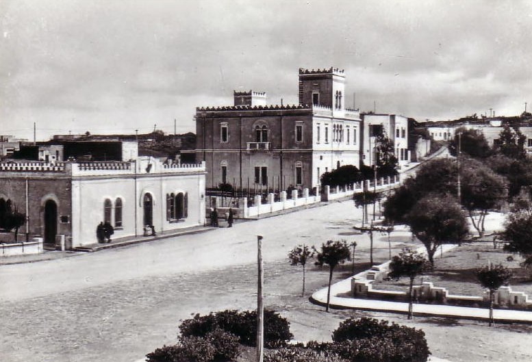
的黎波里
的黎波里(阿拉伯语:طرابلس),位於北緯32°54'8"、東經13°11'9",2011年人口180萬人,位處利比亚西北部沙漠的邊緣及地中海沿岸,是该国首都,也是该国最大城市、主要港口、最大商业和制造中心。的黎波里於公元前7世纪由腓尼基人建立。由於城市歷史悠久,那裡有很多重要的考古發現。當地氣候屬於典型地中海型氣候,夏天乾燥酷熱,冬天時有冷雨。
的黎波里 Wikipedia頁面


關於我們的數據
本页面上的数据是使用许多公开可用的工具和资源估算的。它不附带任何担保,可能包含不准确之处。使用风险自负。