產業領域
比通按行业的企业分布
| 行業說明 | 機構數 |
|---|---|
| 宗教 | 20 |
比通事实
| 區 | 143.9 km² |
| 人口 | 237,292 |
| 男性人口 | 121,351 (51.1%) |
| 女性人口 | 115,941 (48.9%) |
| 人口变化(1975 to 2020) | +353.7% |
| 人口变化(2000 to 2020) | +66.8% |
| 年齡中位數 | 27.2岁 (男:26.7,女:27.7) |
| 人均GDP(購買力平價) | $14,417 (2022) |
| 电话区号 | 21, 4, 438 |
| 鄰近社區 | Aertembaga Satu, Aertembaga, Bitung Timur, Maesa, Girian Indah, Girian, Bitung, Bitung Barat Dua, Maesa |
| 當地時間 | |
| 時區 | 印度尼西亚中部时间 |
| 經度與緯度 | 1.45697, 125.18950 |
| 邮政编码 | 95237, 95511, 95512, 95513, 95514, More |
比通的地圖
互動地圖
比通的人口
1975年至2030年
| Data | 1975 | 1990 | 2000 | 2015 | 2020 | 2025* | 2030* |
|---|---|---|---|---|---|---|---|
| 人口 | 52,301 | 100,167 | 142,257 | 224,492 | 237,292 | 257,936 | 280,708 |
| 人口密度 | 363.4 / km² | 695.9 / km² | 988.3 / km² | 1,559.6 / km² | 1,648.6 / km² | 1,792 / km² | 1,950.2 / km² |
* 预测
来源: JRC (European Commission's Joint Research Centre) 工作于 GHS built-up grid比通从2000年到2020年的人口变化
从2000年到2020年增长了66.8%
| 位置 | 自1975以来的变化 | 自1990以来的变化 | 自2000以来的变化 |
|---|---|---|---|
| 比通 | +353.7% | +136.9% | +66.8% |
| 北苏拉威西省 | — | — | — |
| 印度尼西亚 | — | — | — |
来源: JRC (European Commission's Joint Research Centre) 工作于 GHS built-up grid
比通的中位年龄
中位年龄:27.2岁
| 位置 | 年齡中位數 | 中位年齡(女) | 中位年齡(男) |
|---|---|---|---|
| 比通 | 27.2 yrs | 27.7 yrs | 26.7 yrs |
| 北苏拉威西省 | 29.1 yrs | 29.5 yrs | 28.7 yrs |
| 印度尼西亚 | 27.2 yrs | 27.5 yrs | 26.9 yrs |
来源: CIESIN (Center for International Earth Science Information Network)
比通的人口密度
人口密度:1,649 / km²
| 位置 | 人口 | 區 | 密度 |
|---|---|---|---|
| 比通 | 237,292 | 143.9 km² | 1,649 / km² |
| 北苏拉威西省 | 2.4 million | 14,665.5 km² | 161 / km² |
| 印度尼西亚 | 252.8 million | 1,893,657.8 km² | 134 / km² |
来源: JRC (European Commission's Joint Research Centre) 工作于 GHS built-up grid
比通的历史和预测人口
从1810到2100的估计人口
来源:
- JRC (European Commission's Joint Research Centre) 工作于 GHS built-up grid
- CIESIN (Center for International Earth Science Information Network)
- [鏈接] Klein Goldewijk, K., Beusen, A., Doelman, J., and Stehfest, E.: Anthropogenic land use estimates for the Holocene – HYDE 3.2, Earth Syst. Sci. Data, 9, 927–953, https://doi.org/10.5194/essd-9-927-2017, 2017.
比通的街区
比通各街区企业占比
电话区号
比通的企業使用的區碼百分比
邮政编码
比通各邮政编码企业占比
价格分布
比通企業(按價格分佈)
人類發展指數(HDI)
預期壽命,教育程度和人均收入的統計綜合指數。
来源: [鏈接] Kummu, M., Taka, M. &Guillaume, J. Gridded global datasets for Gross Domestic Product and Human Development Index over 1990–2015. Sci Data 5, 180004 (2018) doi:10.1038/sdata.2018.4
比通的國內生產毛額(GDP)
人均GDP,購買力平價(2017年不變國際元)
| Data | 1990 | 1995 | 2000 | 2005 | 2010 | 2015 | 2020 | 2022 |
|---|---|---|---|---|---|---|---|---|
| 人均GDP | $2,339 | $2,854 | $2,683 | $3,536 | $4,885 | $4,959 | $8,357 | $14,417 |
| GDP總量 | $2.3亿 | $3.2亿 | $3.4亿 | $5.2亿 | $8.4亿 | $9.3亿 | $17.2亿 | $30.7亿 |
来源: [鏈接] Kummu, M., Kosonen, M. & Masoumzadeh Sayyar, S. Downscaled gridded global dataset for gross domestic product (GDP) per capita PPP over 1990–2022. Sci Data 12, 178 (2025) doi:10.1038/s41597-025-04487-x
比通的CO2排放
每年人均二氧化碳(CO2)排放量(噸)
| 位置 | 二氧化碳排放量 | 人均二氧化碳排放量 | 二氧化碳排放強度 |
|---|---|---|---|
| 比通 | 360,237 tn | 1.52 tn | 2,502.7 tons/km² |
| 北苏拉威西省 | 4,296,994 tn | 1.82 tn | 293 tons/km² |
| 印度尼西亚 | 478,610,416 tn | 1.89 tn | 252.7 tons/km² |
来源: [鏈接] Moran, D., Kanemoto K; Jiborn, M., Wood, R., Többen, J., and Seto, K.C. (2018) Carbon footprints of 13,000 cities. Environmental Research Letters DOI: 10.1088/1748-9326/aac72a
比通的CO2排放
| 2013年CO2排放量(吨/年) | 360,237 tn |
| 2013年人均CO2排放量(吨/年) | 1.52 tn |
| 2013年CO2排放强度(吨/km²/年) | 2,502.7 tons/km² |
自然災害風險
相對風險(滿分10分)
| 危险 | 风险级别 |
|---|---|
| 乾旱 | 高 (7.9) |
| 洪水 | 中等 (4) |
| 地震 | 中等 (5.8) |
| 滑坡 | 高 (9) |
| 火山 | 高 (9) |
*風險可能並不涉及整個地區,尤其是洪水或山體滑坡。
来源:
- Dilley, M., R.S. Chen, U. Deichmann, A.L. Lerner-Lam, M. Arnold, J. Agwe, P. Buys, O. Kjekstad, B. Lyon, and G. Yetman. 2005. Natural Disaster Hotspots: A Global Risk Analysis. Washington, D.C.: World Bank. https://doi.org/10.1596/0-8213-5930-4.
- Center for Hazards and Risk Research - CHRR - Columbia University, Center for International Earth Science Information Network - CIESIN - Columbia University, and Norwegian Geotechnical Institute - NGI. 2005. Global Landslide Hazard Distribution. Palisades, NY: NASA Socioeconomic Data and Applications Center (SEDAC). https://doi.org/10.7927/H4P848VZ.
- Center for Hazards and Risk Research - CHRR - Columbia University, Center for International Earth Science Information Network - CIESIN - Columbia University, and International Research Institute for Climate and Society - IRI - Columbia University. 2005. Global Drought Hazard Frequency and Distribution. Palisades, NY: NASA Socioeconomic Data and Applications Center (SEDAC). https://doi.org/10.7927/H4VX0DFT.
- Center for Hazards and Risk Research - CHRR - Columbia University, Center for International Earth Science Information Network - CIESIN - Columbia University. 2005. Global Flood Hazard Frequency and Distribution. Palisades, NY: NASA Socioeconomic Data and Applications Center (SEDAC). https://doi.org/10.7927/H4668B3D.
- Center for Hazards and Risk Research - CHRR - Columbia University, Center for International Earth Science Information Network - CIESIN - Columbia University. 2005. Global Volcano Hazard Frequency and Distribution. Palisades, NY: NASA Socioeconomic Data and Applications Center (SEDAC). https://doi.org/10.7927/H4BR8Q45.
- Center for Hazards and Risk Research - CHRR - Columbia University, Center for International Earth Science Information Network - CIESIN - Columbia University. 2005. Global Earthquake Hazard Distribution - Peak Ground Acceleration. Palisades, NY: NASA Socioeconomic Data and Applications Center (SEDAC). https://doi.org/10.7927/H4BZ63ZS.
最近的附近地震
幅度3.0以上
| 日▼ | 時間↕ | Magnitude↕ | Distance↕ | 深度↕ | 位置↕ | 鏈接 |
|---|---|---|---|---|---|---|
| 4/18/19 | 9:31 PM | 4.5 | 24.2 km | 170,050 m | 25km N of Bitung, Indonesia | usgs.gov |
| 11/21/18 | 6:39 AM | 4.7 | 54 km | 69,440 m | 52km SSE of Bitung, Indonesia | usgs.gov |
| 10/13/18 | 4:34 AM | 5.2 | 14.8 km | 97,150 m | 16km ENE of Bitung, Indonesia | usgs.gov |
| 8/29/18 | 12:02 PM | 4.9 | 55.6 km | 55,080 m | 54km SSE of Bitung, Indonesia | usgs.gov |
| 4/2/18 | 7:23 PM | 4.6 | 34.9 km | 193,710 m | 17km NNW of Laikit, Laikit II (Dimembe), Indonesia | usgs.gov |
| 3/14/18 | 2:26 PM | 4.7 | 47.5 km | 43,880 m | 48km E of Bitung, Indonesia | usgs.gov |
| 8/21/17 | 11:31 PM | 4.5 | 55.2 km | 134,190 m | 27km S of Tondano, Indonesia | usgs.gov |
| 10/10/16 | 8:24 AM | 4.1 | 44.2 km | 550,800 m | 15km N of Manado, Indonesia | usgs.gov |
| 9/27/16 | 9:35 AM | 4.1 | 46.2 km | 35,000 m | 6km WNW of Tomohon, Indonesia | usgs.gov |
| 6/1/16 | 7:12 PM | 4.2 | 45.3 km | 153,380 m | 19km N of Manado, Indonesia | usgs.gov |
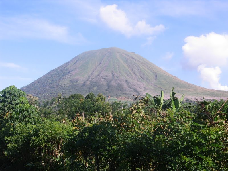
比通
比通(Bitung),印度尼西亚苏拉威西岛北部一海港城市,位于北苏拉威西半岛的最东端,距省会万鸦老数十公里,属北苏拉威西省,面积1583平方公里,人口超过100000人。
比通 Wikipedia頁面


關於我們的數據
本页面上的数据是使用许多公开可用的工具和资源估算的。它不附带任何担保,可能包含不准确之处。使用风险自负。